Client: Department Roads, Bhutan
Funding Agency: Asian Development Bank
Period: August 2006 to December 2007
Consulting Association: Druk Consultancy, GEOCE Consultants (P) Ltd
Approx. Value of Services: Total-US$ 282,555; GEOCE’s part US$ 170,000
Professional Staff Input: International (32) and National (8) person months. GEOCE provided international staff
Salient Details:
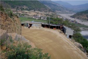
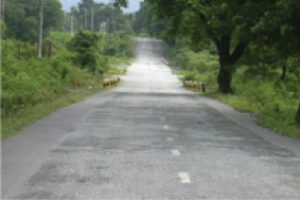
Road Network Project comprised of: (i) periodic maintenance, rehabilitation and improvement of Trongsa-Gelephu National Highway (i.e.NH3) in about 121 km selected sections (i.e. Gelephu-Tingtibi, 97.6 km and Kuenga Rabten – Trongsa, 23 km); construction of about 16 km realignment of NH3 (between Tingtibi and Wangdigang bridge): and upgrading of two bridges (Wangdigang and Yeshigang); and (ii) construction of 4 new feeder roads -111 km, which include Autsho-Garbagtang (54 km) and Kharthungla-Kangpara (34.5 km) in the eastern region and Mirchim-Bongo (16.5 km)and Tekizam-Bjena(6.4 km) in the western region. Moreover, the project will contribute to enhance capacity of DOR for managing road asset; and equip to develop private sector participation in domestic construction industry. The project cost is US$ 34.1 million.
The scope of services:
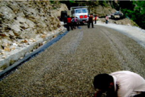
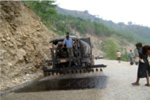
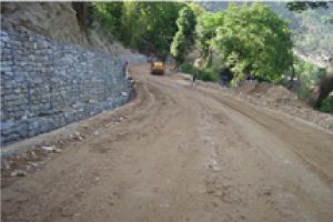
- Design of periodic maintenance, rehabilitation and improvement of 121 km sections of NH3; major services included engineering surveys, road inventory survey, pavement surveys and investigation, geological study and geotechnical investigation of landslides, construction material survey, drainage study; design of geometry improvement, retaining structures, drainage improvement (side drains, culverts and causeways), landslide stabilization (11 major landslide/road sinking spots), gully erosion protection, pavement (strengthening with asphalt concrete and granular overlays, resurfacing with DBST), river protection, bioengineering, road and traffic safety measures. Many of these major landslides encompass road sinking, which was unfavourable to road serviceability and involved constant maintenance of road. The landslides/road sinking was triggered due to poor water management, river action and specific site problems with geology and topography. The design included stabilization measures with specialized techniques such as anchor retaining walls, sub-surface drainage, which was combined with conventional measures to enable effectiveness, economy, and use of available construction technology.
- Design review and finalization of Realignment of NH3 (8.4 km) comprising design update/redesign of road geometry as required to improve mass balance, rock slope protection, drainage (side drain and culverts), and DBST pavement.
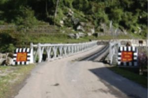
- Design review and finalization of bridge upgrading comprising Wangdigang and Yeshigang bridges. The design for upgrading of these existing Bailey bridges consisted of (43 m and 34 m, single span, steel bridges with RCC deck). Yeshigang Bridge was partly damaged due to floods in 2004.
- Design review and finalization of 4 feeder roads and bridges, which included (Tekizam-Bjena, Mirchim-Bongo, and sections of Autsho-Garbagtang and Kharthungla-Kangpara – total 66 km) and 9 bridges -2 no RCC (15 and 25 m span) and 7 no Bailey bridges-18 to 58 m span).
- Preparation of Resettlement Plans (RPs) of 4 feeder roads as per ADB’s Policy on Involuntary Resettlement (1995). The Handbook on Resettlement: A Guide to Good Practice (1998) and agreed resettlement framework.
- Update of Environmental Management Plan (EMP) for road and bridge works. This included update of EMP prepared at the time of PPTA. The updated EMP included general and site specific consideration to avoid/mitigate any negative environmental impact. The project sections of NH3 and its realignment section pass through protected national parks.
- Preparation of bid documents including evaluation criteria for procurement of civil works contracts based on Single Stage, Two Envelope bidding system using Standard Bidding Documents (SBD)-Procurement of Works of ADB. Technical specifications were prepared to enable self- contained scope and coverage.